-40%
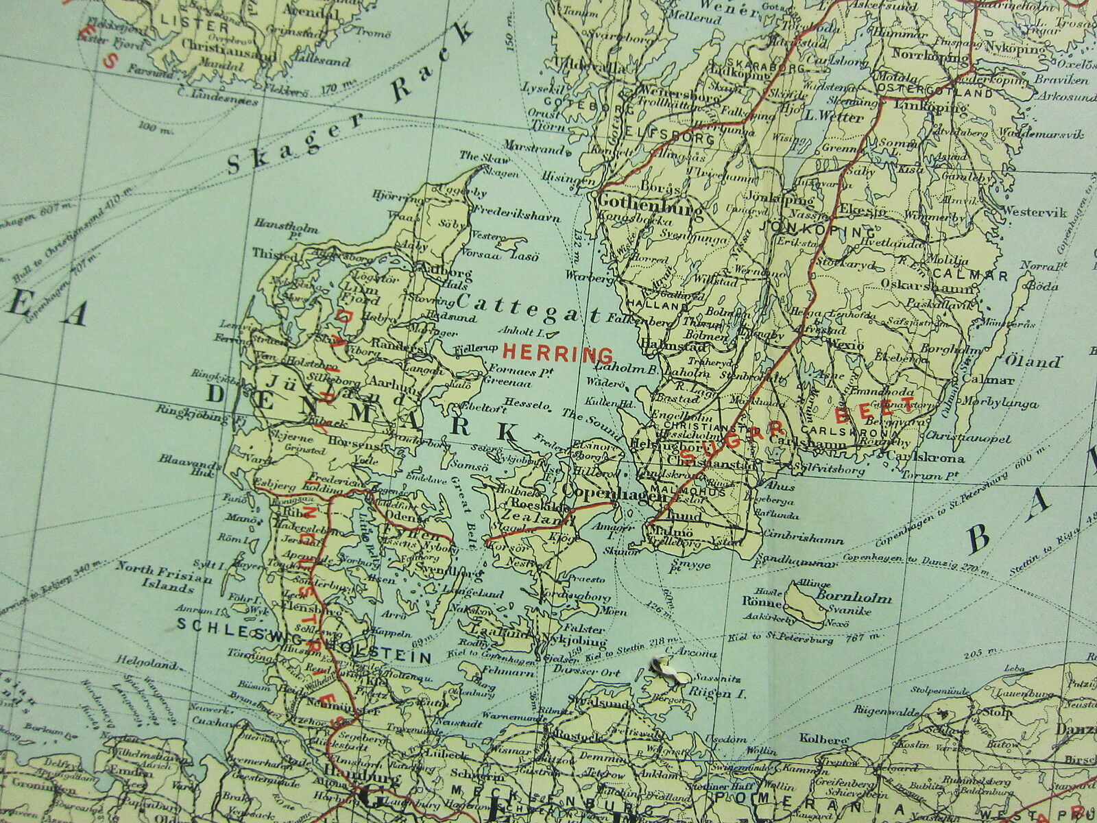
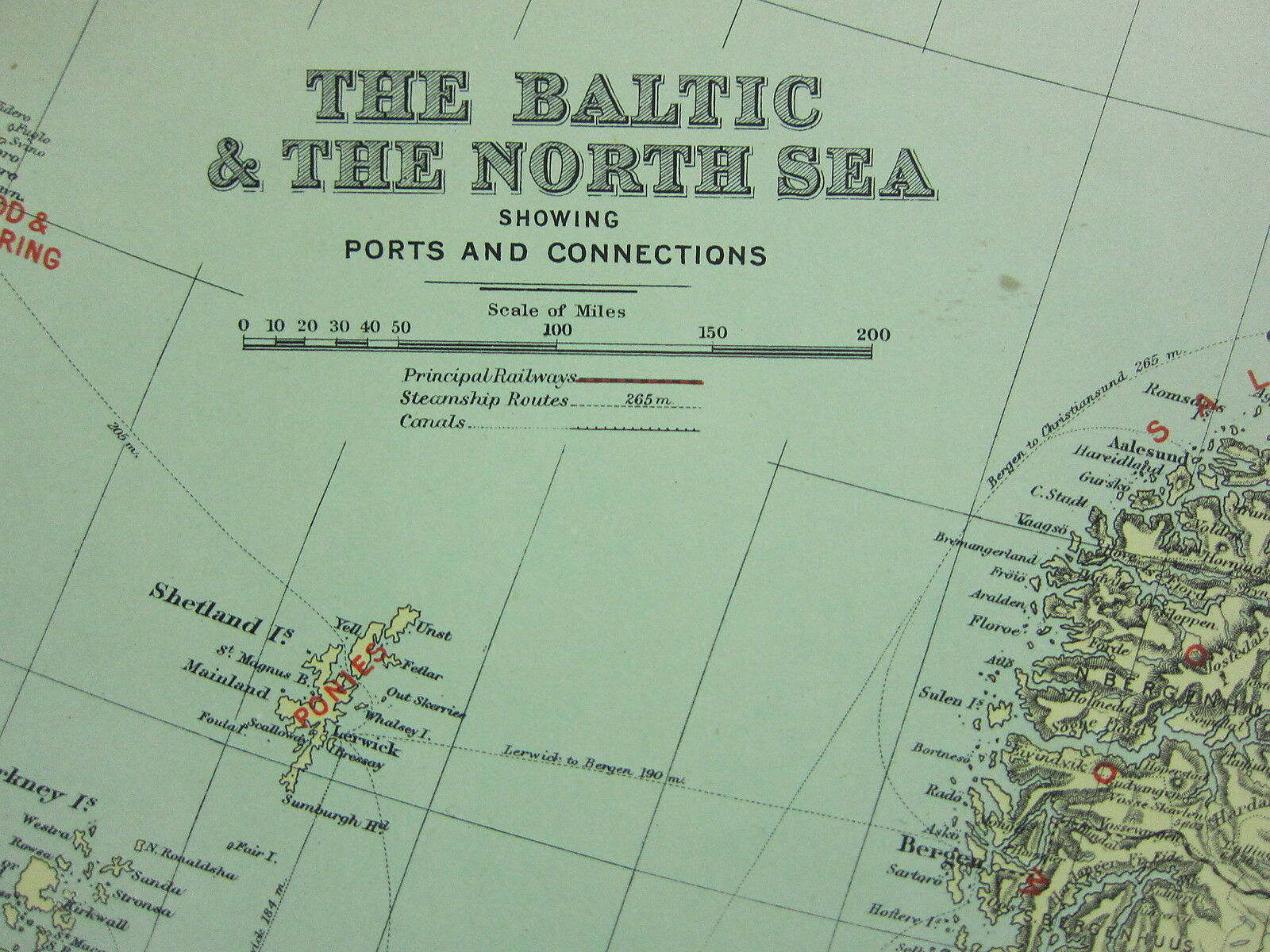
1912 LARGE ANTIQUE MAP ~ THE BALTIC & NORTH SEA ~ PORTS & CONNECTIONS
$ 42.14
- Description
- Size Guide
Description
A beautiful antique map on fine quality paper VERY GOOD condition and rescued from a disbound atlas:BACON'S ATLAS of the WORLD
1912 (commercial and library)
Map produced & printed by:
Bacon's Geographical Establishment
SUPERB DETAIL
THIS ATTRACTIVE MAP IS AN ORIGINAL
OVER 100 YEARS OLD
AND NOT A REPRODUCTION
This
FOLD-OUT
map measures approximately
19 inches by 13 inches
(485mm x 335mm)
~
Printed on fine quality paper
Free from any text on the reverse
A superb map in very good condition
~ Minor handling/age related marks at the extremities
~
Please email with any questions regarding this item
(Bacon's commercial and library atlas 1912)
BEST OFFERS PLEASE FOR A
QUICK SALE AT A FAIR PRICE
If you like the item, but do not like the price,
then make a realistic offer to us using the
MAKE OFFER BUTTON
Powered by
eBay Turbo Lister
BACON'S ATLAS of the WORLD 1912 (commercial and library) Map produced & printed by: Bacon's Geographical Establishment SUPERB DETAIL THIS ATTRACTIVE MAP IS AN ORIGINAL OVER 100 YEARS OLD AND NOT A REPRODUCTION This FOLD-OUT map measures approximately 19 inches by 13 inches (485mm x 335mm) ~ Printed on fine quality paper Free from any text on the reverse A superb map in very good condition (Bacon's commercial and library atlas 1912) BEST OFFERS PLEASE FOR A QUICK SALE AT A FAIR PRICE then make a realistic offer to us using the MAKE OFFER BUTTON Powere
BACON'S ATLAS of the WORLD 1912 (commercial and library) Map produced & printed by: Bacon's Geographical Establishment SUPERB DETAIL THIS ATTRACTIVE MAP IS AN ORIGINAL OVER 100 YEARS OLD AND NOT A REPRODUCTION This FOLD-OUT map measures approximately 19 inches by 13 inches (485mm x 335mm) ~ Printed on fine quality paper Free from any text on the reverse A superb map in very good condition (Bacon's commercial and library atlas 1912) BEST OFFERS PLEASE FOR A QUICK SALE AT A FAIR PRICE then make a realistic offer to us using the MAKE OFFER BUTTON Powere
BACON'S ATLAS of the WORLD 1912 (commercial and library) Map produced & printed by: Bacon's Geographical Establishment SUPERB DETAIL THIS ATTRACTIVE MAP IS AN ORIGINAL OVER 100 YEARS OLD AND NOT A REPRODUCTION This FOLD-OUT map measures approximately 19 inches by 13 inches (485mm x 335mm) ~ Printed on fine quality paper Free from any text on the reverse A superb map in very good condition (Bacon's commercial and library atlas 1912) BEST OFFERS PLEASE FOR A QUICK SALE AT A FAIR PRICE then make a realistic offer to us using the MAKE OFFER BUTTON Powere
BACON'S ATLAS of the WORLD 1912 (commercial and library) Map produced & printed by: Bacon's Geographical Establishment SUPERB DETAIL THIS ATTRACTIVE MAP IS AN ORIGINAL OVER 100 YEARS OLD AND NOT A REPRODUCTION This FOLD-OUT map measures approximately 19 inches by 13 inches (485mm x 335mm) ~ Printed on fine quality paper Free from any text on the reverse A superb map in very good condition (Bacon's commercial and library atlas 1912) BEST OFFERS PLEASE FOR A QUICK SALE AT A FAIR PRICE then make a realistic offer to us using the MAKE OFFER BUTTON Powere
BACON'S ATLAS of the WORLD 1912 (commercial and library) Map produced & printed by: Bacon's Geographical Establishment SUPERB DETAIL THIS ATTRACTIVE MAP IS AN ORIGINAL OVER 100 YEARS OLD AND NOT A REPRODUCTION This FOLD-OUT map measures approximately 19 inches by 13 inches (485mm x 335mm) ~ Printed on fine quality paper Free from any text on the reverse A superb map in very good condition (Bacon's commercial and library atlas 1912) BEST OFFERS PLEASE FOR A QUICK SALE AT A FAIR PRICE then make a realistic offer to us using the MAKE OFFER BUTTON Powere
BACON'S ATLAS of the WORLD 1912 (commercial and library) Map produced & printed by: Bacon's Geographical Establishment SUPERB DETAIL THIS ATTRACTIVE MAP IS AN ORIGINAL OVER 100 YEARS OLD AND NOT A REPRODUCTION This FOLD-OUT map measures approximately 19 inches by 13 inches (485mm x 335mm) ~ Printed on fine quality paper Free from any text on the reverse A superb map in very good condition (Bacon's commercial and library atlas 1912) BEST OFFERS PLEASE FOR A QUICK SALE AT A FAIR PRICE then make a realistic offer to us using the MAKE OFFER BUTTON Powere

